Geometry sets range, visibility, and propagation time (see source and destination).
When Does a Path Exist?
- Earth, terrain, or structures can block line of sight
- Service begins above a minimum elevation (the elevation mask), not at the local horizon (0°)
- The slant range from ground station to spacecraft changes throughout the pass
- Design to the worst useful geometry — not merely visibility
Elevation mask trade
- Higher elevation mask → shorter maximum range (less maximum path loss) but less contact time
A Pass Is Not One Range
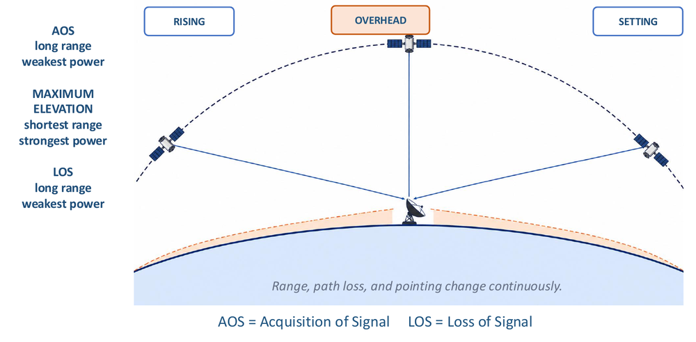
- AOS (Acquisition of Signal), rising: long range, weakest power
- Maximum elevation, overhead: shortest range, strongest power
- LOS (Loss of Signal), setting: long range, weakest power
- Range, path loss, and pointing change continuously over the pass
Slant Range
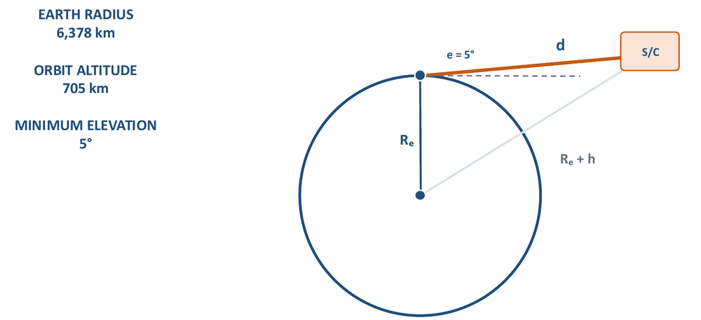
Slant Range
- = Earth radius, = orbit altitude, = elevation angle at the ground station
- At :
Where it comes from
- Triangle (Earth center, station, spacecraft): sides , , , with angle at the station
- Law of cosines:
- Take the positive root of the quadratic and use to get the boxed result
TERPSat Link Geometry
- , ,
- Overhead ():
- Geometry alone creates a range swing over the pass
- Path-loss cost of that swing: 11.2 dB
Homework 2: Slant Range
- Circular orbit 500 km above Earth; slant range at 10° elevation?
- , ,
- Follow-up questions:
- Why does a higher minimum elevation reduce maximum path loss? (it caps the longest slant range in the pass) (not on slide)
- What happens to contact time? (it shrinks — the elevation mask trade above) (not on slide)