High-latitude communication, prolonged coverage at apogee, specialized scientific missions
GEO = “Geosynchronous Equatorial Orbit”
The MEO upper bound is printed as 35,286 km in the slide; presumably the GEO altitude of ~35,786 km
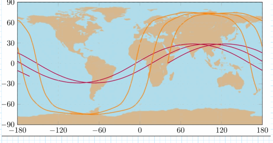
Groundtracks
Groundtrack: the path traced on the Earth’s surface by the point directly below the satellite
Purple: a low-inclination orbit, oscillating between about latitude
Orange: a high-inclination orbit, reaching about latitude
The highest latitude reached equals the inclination (for )
Each revolution’s track is shifted west of the previous one, because the Earth rotates underneath
A zoomed map (shared over Zoom) shows a figure-eight groundtrack centered on the equator: the track of a
geosynchronous orbit that is not exactly equatorial